

As Pennsylvania county parks go, Chester County’s Warwick is a shining example. For the most part, it seems Counties prefer to leave land wild, subtly managed with fewer amenities than one might find at municipal parks– advantageous for runners trying to get lost in nature.
The flat part of Warwick is flanked by French Creek and Route 23 and is contained between two picturesque hilly roads– County Park Road to the west and Mt. Pleasant Road to the East. It is heavily wooded except for a big field at the entrance. The main trails run parallel to one another, east to west, either along a diverse hardwood hillside or near the beautiful creek.
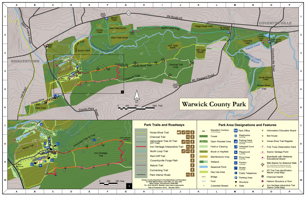
We prefer parking on Route 23 and entering the North Access Gate, 1F on the map. There is only room for 3-4 vehicles there and fewer trail users. There is ample parking in Warwick’s main entrance and two points on Mt. Pleasant Road, but the starts are less interesting and you’re bound to encounter more traffic before you get into your pace. There’s also a trailhead at the crest of Coventry Road, across the street from French Creek Elementary School where Horseshoe Trail enters the park. This is also a decent run but there’s a pretty major creek crossing and it’s an out and back.
Since we loathe out and backs we’ll describe the only real loop Warwick offers.
Starting at the northernmost trailhead you’ll run downhill at a grade that’ll wake your thighs up before you encounter an intersection about halfway down. Turning left keeps you on the main North Loop Trail while turning right (or west) offers a little bonus loop around Conifer Field, a replanted meadow with bird boxes peppering the trailside. You will see all manner of Pennsylvania wildlife at Warwick including many species of birds and herds of whitetail. On our last run a fox trotted in front of us as we ran up the North Loop Trail.
Most runners complete the loop around the field and connect back onto the North Loop to cross the creek on Mt Pleasant Road to enter the park’s other trails. If you do this and still want to run a full loop you can exit the park through the main entrance and run a road mile back to the North Gate.
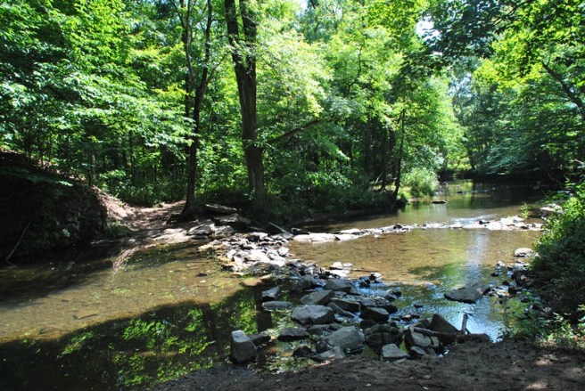
But the better way is to run to a scenic vantage point at the westernmost side of Conifer Field, descend down a little spur to the creekside and cross French Creek. It’s slightly precarious but, if you can stay dry, you’ll happily enter the hard-packed single track of Red Cliff Trail, so named because the reverse side of the vista you just descended. It’s not the world’s greatest cliff but we’re not the world’s greatest trail runners.
This trail heads toward the park’s main entrance and if you stay on the Park’s boundary and head up hill, with County Park Road on you’re right, you’ll be on part of Owen J. Robert’s High School XC course.
The top of that hill intersects with the Horseshoe Trail which you’ll take left across the field toward a bench in the corner where exceptional sunsets can be enjoyed. Before running into the woods you’ll pass an interesting observation deck where you can incorporate stair climbs into the run, 5D on the map.
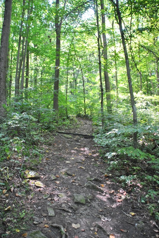
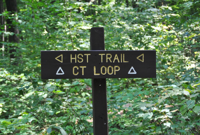
Now is when Warwick gets good! The Charcoal Trail is a rocky single track that undulates with seemingly steeper and steeper punchy little climbs. This is an excellent trail for manageable climbing intervals in either direction. If you’re not up to hill repeats, running the Charcoal Trail with a sustained pace is a suitable substitute – West to East, the rollercoaster swales keep getting a little longer and a little steeper… and a little more technical. Eventually though, you’ve reached the top and you can fly along on a smooth -2% grade for a good clip. Just when you feel like you could run like this forever the wide trail transitions to a narrow steep downhill. Not quite a washout, this part of the trail is the most technical in Warwick and connects back to HST.
This easternmost part of the Charcoal Trail also features a couple of intersections that lead to private property so be an alert. In fact, at the bottom of the scramble you’ll turn back into the park to connect to the horseshoe trail when taking the private spur feels more natural to the loop you’re on.
Like a lot of the forests in our neck of the woods, the lands in Warwick Park were once used to both harvest the wood and produce the charcoal used to fuel the iron forges along the Schuylkill Valley. So, not only is Charcoal Trail named for this unique process that defines the history of the region beyond the woods, there are charcoal hearth remnants all along the trail. Today these are mostly just cleared flat areas but some include stone structures.
Now back on a part of the Horseshoe Trail that is very obviously groomed for horseback riding, French Creek will appear on your left. I have never fished this stretch but these are some of the deeper holes I have ever seen in the creek which you will cross again when the trail intersects with Mt. Pleasant Road. Here you have the option of continuing on Horseshoe Trail for a bonus out and back where you can see where Rock Run joins the creek and where French’s south branch splits off to the south.
Our loop proper, though, goes over the Mt. Pleasant Bridge and into a parking area wear there is a trailhead for the North Loop Trail. This is a mostly grass covered double track which, it seems, might be designed for strolling, whith a few strategically placed benches along the trail. The trail undulates but it is much gentler than Charcoal. This is the stretch we frequently XC Ski on when there is snow and it’s also a very popular place to star gaze at night.
The last choice before the short uphill burst to the car is to stay high (North) in Starr Field or low (South). We recommend taking the high road for two reasons. One, it’s less of a non-stop climb to your car and two, the lower trail gets extremely marshy. If it’s dry though, lower Starr Field allows you, after a little bushwhacking, access to a part of French Creek not many humans have seen.
Either way, it’s uphill back to the North Access Gate but, if you’re feeling spry, you can add the reverse of the Conifer Field loop in before heading home from this 4-5 mile run in your County Park.
TRAILRUNS is a series of profiles of the diverse trail running opportunities in Southeastern Pennsylvania– specifically Northern Chester, Western Montgomery, and Southern Berks Counties.
